
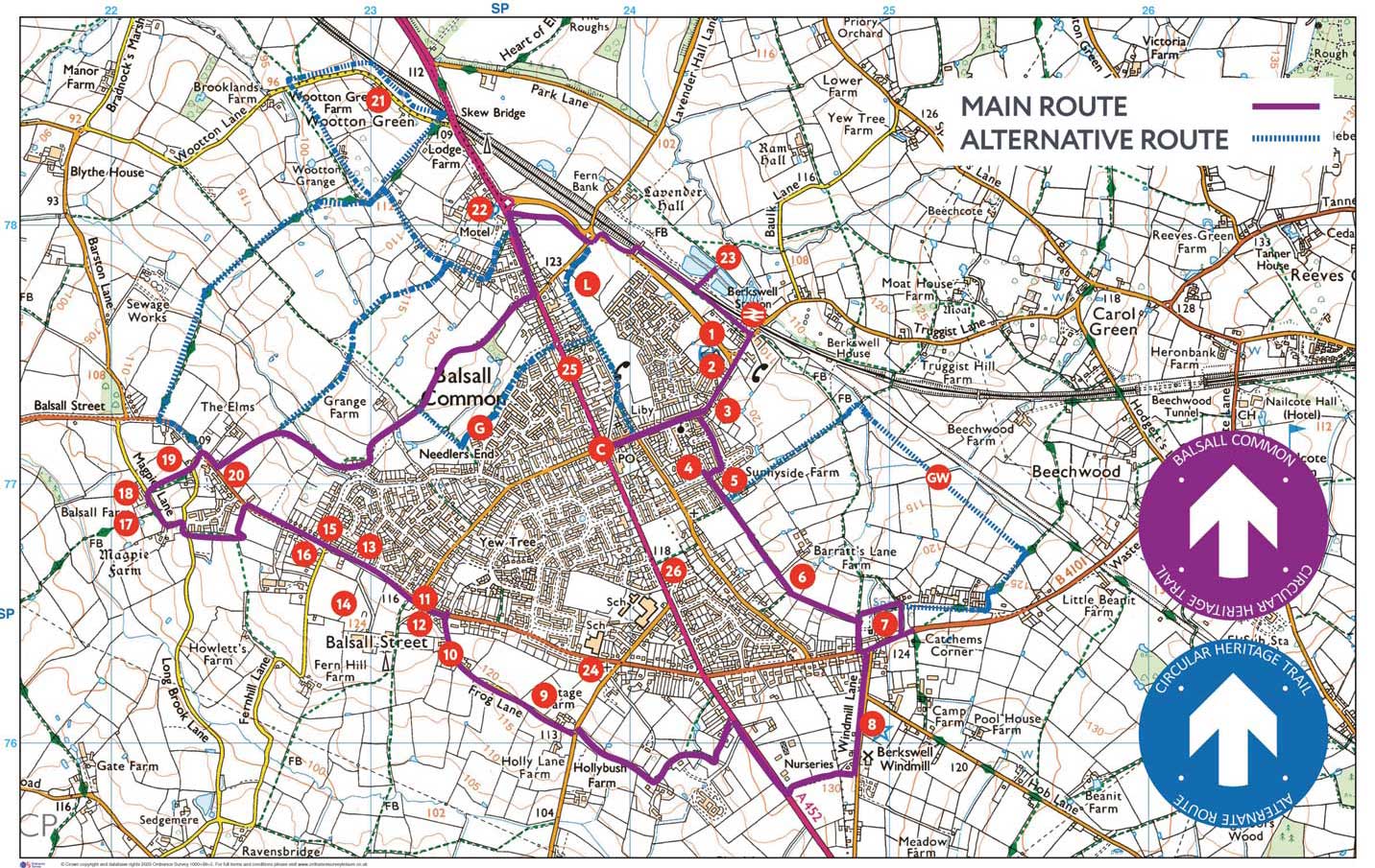
Welcome to the Balsall Common Heritage Circular Trail
Home-
Downloads -
View Route Information -
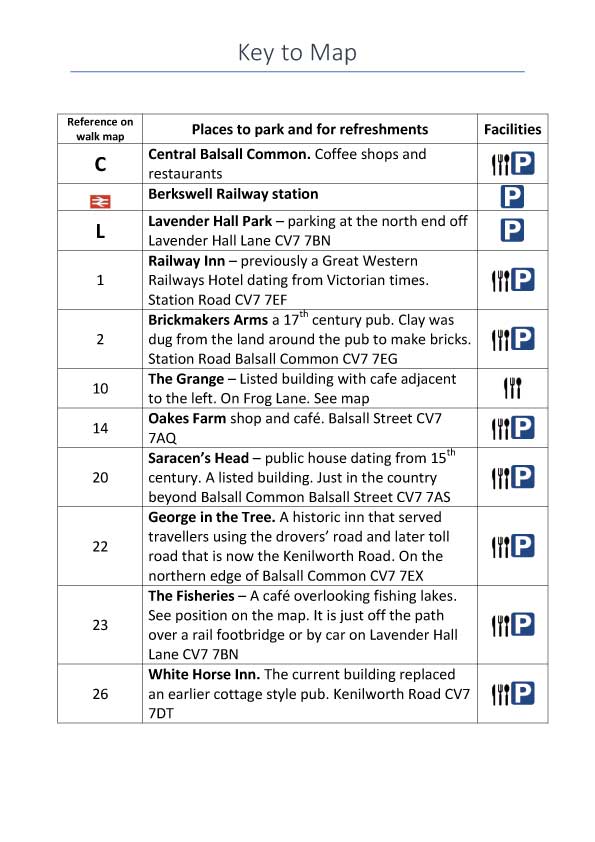
View Locations- The Railway Inn
- Brickmakers Arms
- Ye Olde Berkswell Stores
- Sunnyside House
- Sunnyside Farm
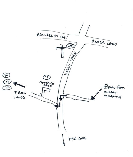
- Pool Orchard
- Barratts Lane Farm House and Barn
- Medieval furrowed field
- Berkswell Windmill
- Cottage Farmhouse
- Frogmore Grange
- Blacksmith’s Corner
- Fernhill Court
- Hobbe Cottage
- Shenstone Grange, Balsall Street
- Wisteria Cottage
- Magpie Farm
- Balsall Farmhouse, Magpie Lane
- Templars Cottage, Balsall Street
- Saracen’s Head
- Blythe Prior
- The George in the Tree
- St Peter’s Church
- Crathie No.1 Turnpike Close
- The White Horse